Development of a cardio-protection service on the Camino de Santiago using UAVs
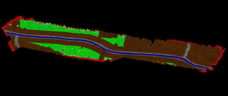
A program that, based on visible cartography (photogrammetry) carried out by the UAS (Unmanned Aerial System) payload, can determine all the possible delivery areas for a medical kit near the objective point of the Camino de Santiago. The delivery points will be detected automatically by an algorithm and must meet the necessary characteristics in terms of slope, radius, amplitude, security, access on foot to the Camino, etc. so that the UAS can approach the delivery area safe enough for a successful healthcare kit delivery.
Objectives
The general objectives of the project are, using photogrammetry data from the neighbourhood of the Camino de Santiago:
- Detection of flat areas that meet the characteristics of the slope, amplitude, etc., that allow the UAS to approach.
- Verification that the detected areas meet the condition of being at a certain distance from elements such as electrical towers, highways or highways, railways and towns.
- Discard the candidate areas without obvious access on foot to the Camino.
- Evaluation of the quality of the result and the computational performance using the data of the selected part of the Camino.
Project
/research/projects/desenvolvemento-dun-servizo-de-cardioproteccion-no-camino-de-santiago-por-medio-de-uavs
<p>A program that, based on visible cartography (photogrammetry) carried out by the UAS (Unmanned Aerial System) payload, can determine all the possible delivery areas for a medical kit near the objective point of the Camino de Santiago. The delivery points will be detected automatically by an algorithm and must meet the necessary characteristics in terms of slope, radius, amplitude, security, access on foot to the Camino, etc. so that the UAS can approach the delivery area safe enough for a successful healthcare kit delivery.</p><p>The general objectives of the project are, using photogrammetry data from the neighbourhood of the Camino de Santiago:</p> <ul> <li>Detection of flat areas that meet the characteristics of the slope, amplitude, etc., that allow the UAS to approach.</li> <li>Verification that the detected areas meet the condition of being at a certain distance from elements such as electrical towers, highways or highways, railways and towns.</li> <li>Discard the candidate areas without obvious access on foot to the Camino.</li> <li>Evaluation of the quality of the result and the computational performance using the data of the selected part of the Camino.</li> </ul> - José Carlos Cabaleiro Domínguez - Silvia Rodríguez Alcaraz, Francisco Fernández Rivera, Tomás Fernández Pena, Óscar García Lorenzo
projects_en